
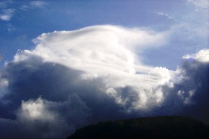
Cumulus lenticularis
On 05 June 2007 at 06:31 in the morning a lenticular cloud formed over Nahnpohnmal and the associated Twemwentwemwensikir ridge line. The technical name for these clouds is (alto)cumulus standing lenticularis. This cloud is likely to be have been at about 600 to 800 meters above sea level and may have formed in association with a ridgeline with a top of around 500 meters.
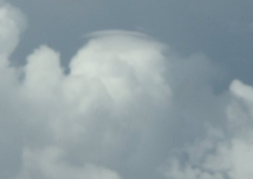
Cumulus lenticularis

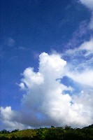
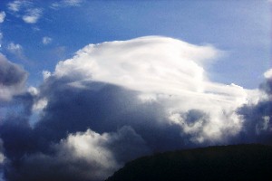
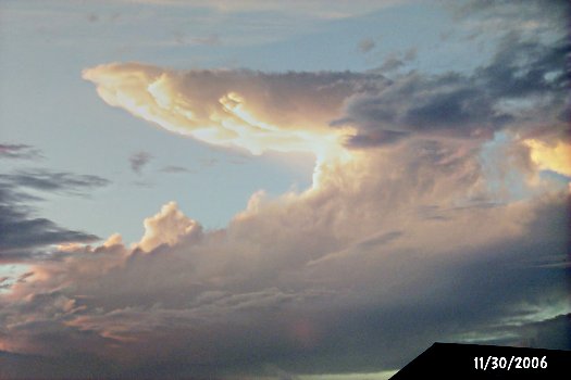
Cumulus humilis building towards cumulus congestus
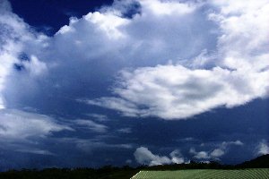
A towering cumulus building towards an anvil topped cumulonimbus. The top was visibly moving upward in real time.
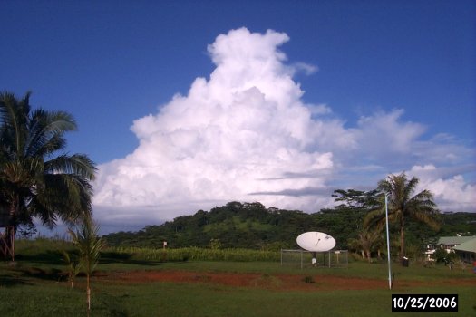
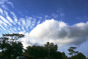
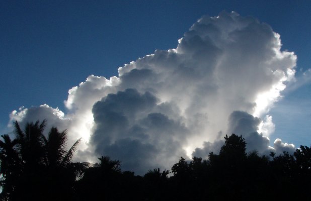
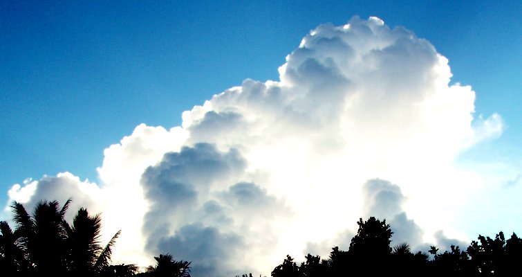
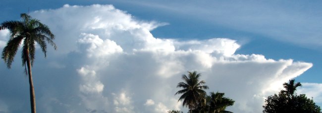
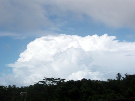
Towering cumulus
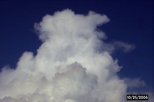
Towering cumulus
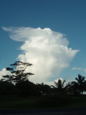
Towering cumulus
Typical cumulus clouds near the campus.
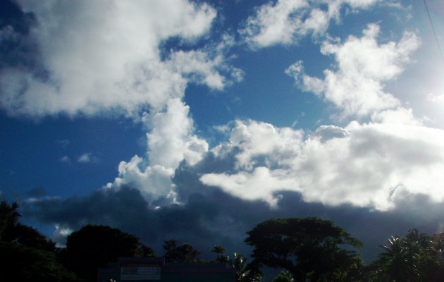
Altocumulus on the left, swelling cumulus on the right.

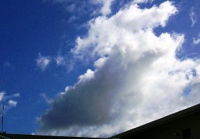
Swelling cumulus
Cumulus experiencing shearing winds aloft.


The two images above were taken roughly two minutes apart. The cloud was moving from right to left. Note the cells increased vertical development. Below are details of the transformation of the left cell above. The images below were taken between the images above.
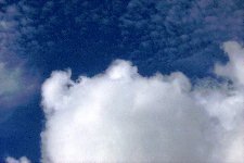
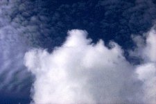
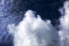
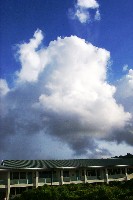
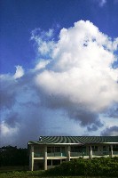
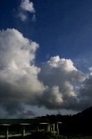
Image above left: Small cumulonimbus with a light rain column descending to the left.
Image above center: Same Cb a few moment later as it moves towards the left side of the frame.
Image above right: cumulus congestus on the right side.
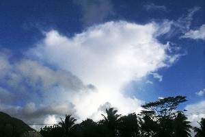
Image above: distant cumulonimbus starting to spread at top.
Multi-cell cumulonimbus line building from right to left
Spreading cumulonimbus top as seen from below. Storm is moving towards the left.

Cumulus castellanus

Cumulus castellanus

Cumulus castellanus
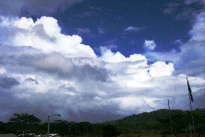
Cumulus congestus west of Kolonia on Monday evening, 08 October 2007
Cumulus congestus

Culumulus congestus build west of campus 12 May 2008
A cumulus congestus develops over the center of Pohnpei on 08 October 2007. In front are smaller cumulus fragments (Cumulus fractus) masking some of the main cloud mass. On the center left is a tower that had formed rapidly and was starting to collapse as this image was taken.
Cumulus fractus in front of cumulus congestus/cumulonimbus cloud mass over island center


Cumulus build under cirrostratus

Cumulus build detail

Cumulus under altocumulus clouds

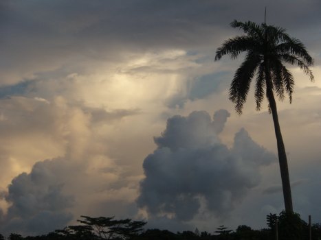
Anvil top cumulonimbus

Cumulonimbus cloud mass east of Kolonia at 0654 10 Ocotber 2007
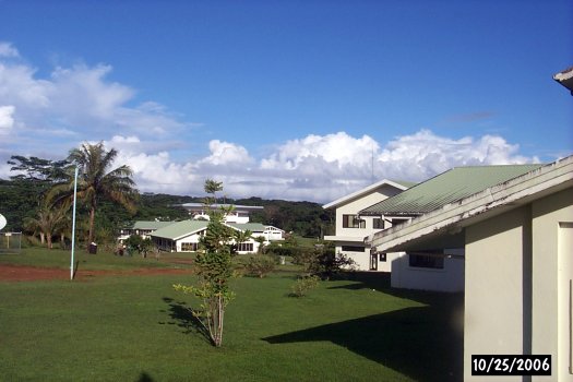
A scenic shot of campus backset by overhead cloud decks and a distant cumulonimbus.
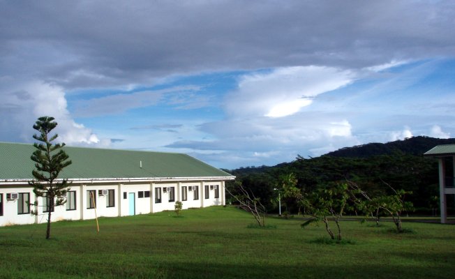
Campus scenic shot
Distant cumulonimbus with temperature inversions at different levels
Thunder and lightning are unusual on Pohnpei. Most of our tropical rain is produced by collision-coalescence. On a rare occasion a single big cb cell will develop enough height to produce the supercooled water and ice crystals necessary for the Bergeron process, charge separation, and attendant lightning and thunder. At 14:41 on the fourth of November a line of thundering cumulonimbus moved across Pohnpei bringing intense and torrential rain along with thunder, lightning, and rain driver wind gusts.
A line of cumulonimbus producing thunder and lightning moving towards Kolonia from the east on the fourth of November.
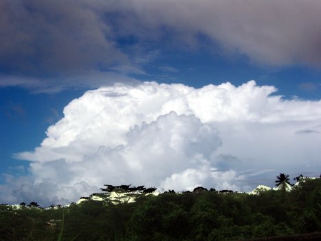
Image leveled to enhance detail
Low level stratus clouds are rare in Pohnpei. Altostratus occurs, but is usually masked by low level cumulus builds. Pileus clouds and ridgetop clouds are seen.
Pileus cloud above a cumulonimbus cloud in Palikir. Left image taken just before right image. Note cumulonimbus "pushing up" into pileus cloud. Another set of images below, with the second image balanced to enhance contrast. These two images were captured on 05 October 2007.
Pileus cap cloud atop cumulonimbus
Ridgeline cap cloud, one of the few low level stratus clouds on Pohnpei.
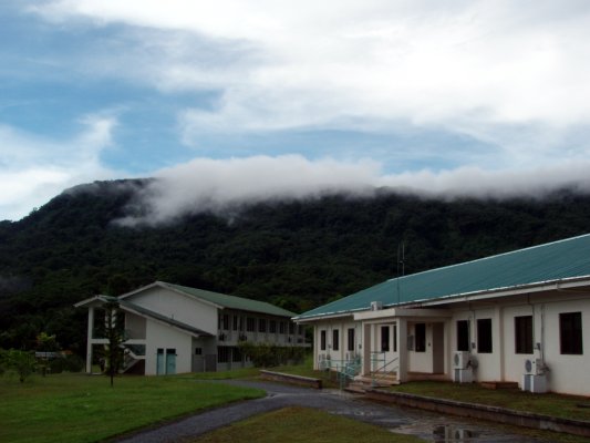
Stratus cloud formed by wind moving over the ridgeline.

A stratus-like cloud deck below cumulonimbus builds

The same image with the sky enhanced for cloud clarity
The following two images were taken sequentially along the ridge line to the east of campus on 30 April 2008

A day of heavy rain cools the air forming a stratus cloud at ground level near the base of the ridge
Note the faintly visible extension of the clouds to the right above. The image below is to the right of the image above along the ridge line.

A retinex filter artificially enhances the contrast on a status cloud hanging over the ridgeline

Another ridge-line stratus cloud.
The following two images were taken at 0738 on 19 May 2008. The stratus-like cloud is to the west of the Palikir national campus on Pohnpei.

Stratus-like cloud with small boils on upper surface of limited vertical extent

The sun was behind clouds to the east of campus at this hour of the morning.
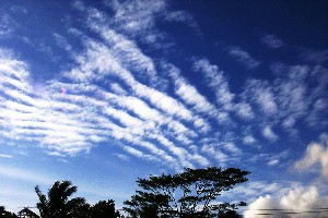
Altocumulus. Winds run perpendicular to cloud lines.
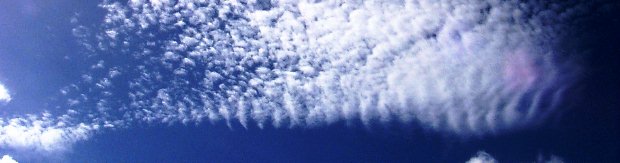
A wave pattern in altocumulus. Winds aloft move perpendicular to wave lines.
Sunrise over the ridge to the east lights up a middle level deck of alto clouds, probably altocumulus.
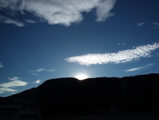
Altocumulus lit by the morning sun

altocumulus

altocumulus

altocumulus

Altocumulus or possible cirrocumulus

Reprocessing of above image using retinex filter

Altocumulus 5/5/2009

Altocumulus 5/5/2009

Altocumulus 5/5/2009
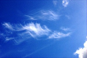
Cirrus clouds. Ice falls into winds blowing from the right.
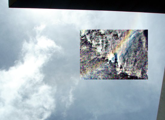
An icebow at noon reveals the presence of high cirrus ice clouds over the campus. The edge of the campus gym roof was used to eclipse the sun. The sun is at the center of an ice bow. Note that while a rainbow appears opposite the sun, an ice bow appears towards the sun. Rainbows include refraction and an internal reflection inside a liquid rain drop. A portion of the image was artificially enhanced using retinex technology to show the colors. The icebow was more visible to the human eye wearing unpolarized sunglasses than to the digital camera's sensors.
Ice clouds aloft, likely cirrostratus, produce an icebow

Cirrus

Cirrus

Cirrus

Cirrus ice crystal clouds producing an icebow at 16:08 on 12 October 2007

Cirrocumulus
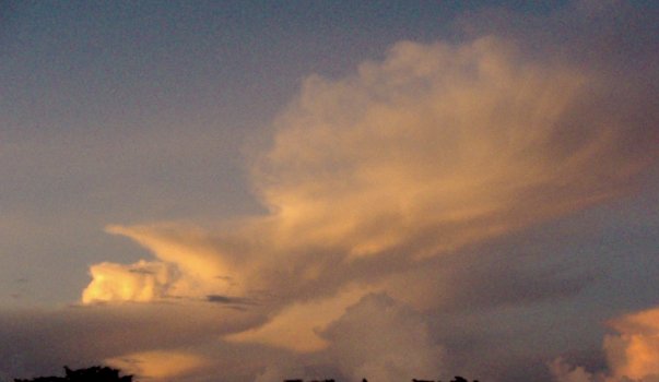
Sunset on the 16th of July seen from the gym. Clouds can have an amazing range of colors. White is not the only cloud color.

Sunset at 18:57 on the 16th of July 2007
18:13 in the evening 30 November 2006
On the morning of the ninth of July the clouds were tinged in a yellowish-grey color.

Sunset hits clouds over the Sokeh's harbor.
Capturing cloud colors is complicated at best. Digital cameras and human eyes do not have the same pigment response curves. Simply changing the setting on the camera can also have a strong impact on image.
Cumulus at 18:09 on 01 November 2007, Olympus digital camera set to default full automatic.
Same cloud with camera set in sunset mode.
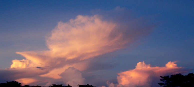
On the seventh of November at 06:26 in the morning the rising sun lit an early morning cumulonimbus and affiliated clouds. Precipitation, possible ice, was visibly sheeting off of the side of the anvil toward image center near the palm tree.
A rain front rolled in later on the ninth of July, replete with mammatus type clouds.


Mamatus (mamma) cloud ahead of a rain line

The rain curtain that followed the mammatus cloud

Artificially rebalanced clouds over the library associated with overhead cumulonimbus complex

To the naked eye the small downward billows on the bottom of this cloud were very regularly spaced and appeared to be periodic - related to some sort of wave-like phenomenon.